
Spatial distribution of monitoring locations in the Berambadi watershed
Berambadi watershed is located near to Gundlupet town in Chamarajanagar district of Karnataka state in South India. The area of watershed is approximately 100 km2. The watershed lies in semi-arid climate zone with a mean annual dominant South-West monsoon rainfall of 800 mm. Based on the latest Köppen-Geiger updated world climate classification, the watershed is classified as AWh (Equatorial, Desert/arid, Dry). It has Bandipur National park at its west boundary. The main three soil types in the area are comprising of black, red and rocky/weathered soils, as identified by the geophysical studies. These are representative of the soil types for granitic/gnessic lithology found in South India. The main land use classes encountered in the area are: dense/closed forest, scrub forest, land with scrub, Kharif (summer) crop, double crop and plantation. During Kharif (summer) and Rabi (winter) marigold, sunflower, finger millet, maize, garlic, sugarcane, sorghum, water-melon, lentils, and groundnut etc., are grown.
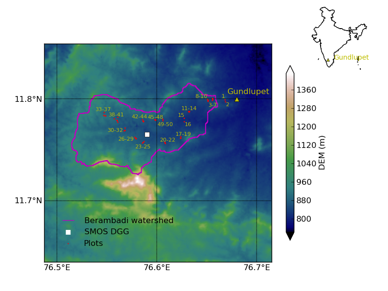
Location of Berambadi watershed inside India (shown in inset) and Digital Elevation Model (DEM). Location of 50 soil moisture measurement plots is also shown.
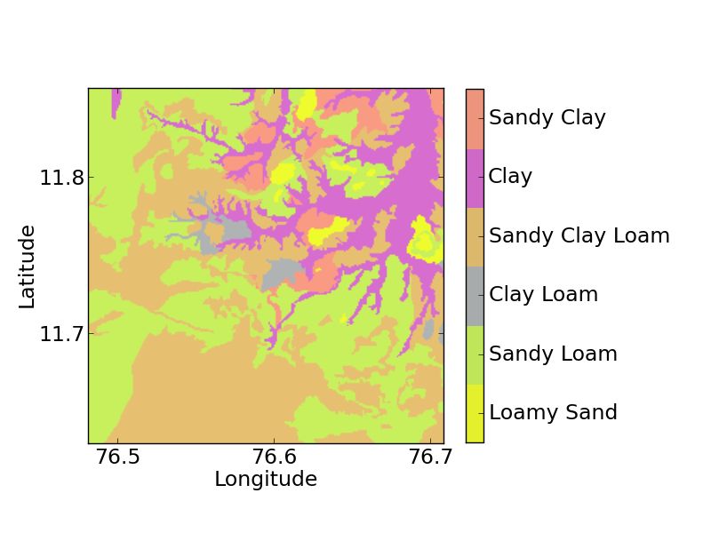
Soil map of the Berambadi watershed.
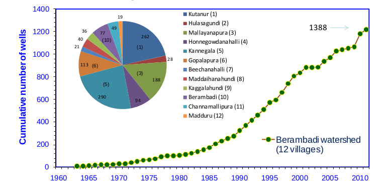
Bore wells in the villages in the watershed
Ongoing studies:
Estimation of Evapotranspiration from Remote Sensing

Spatial map of ET (mm/day) estimated over Berambadi watershed (19 Dec-2013)
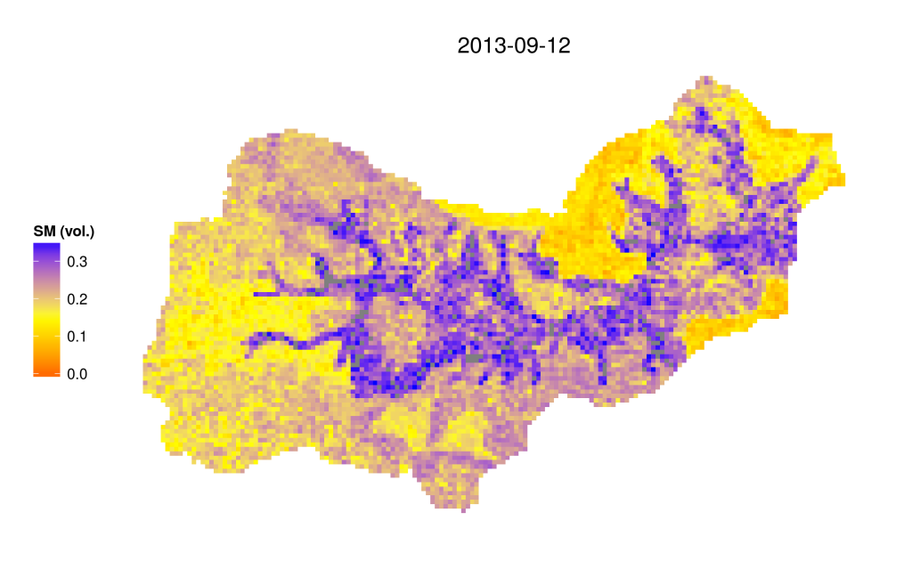
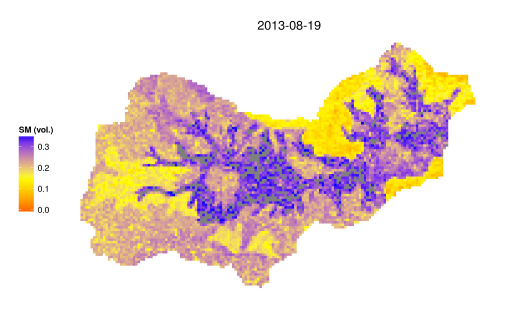
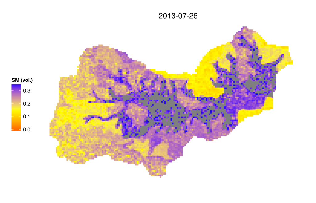
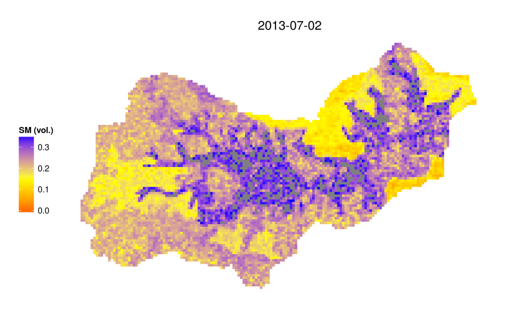
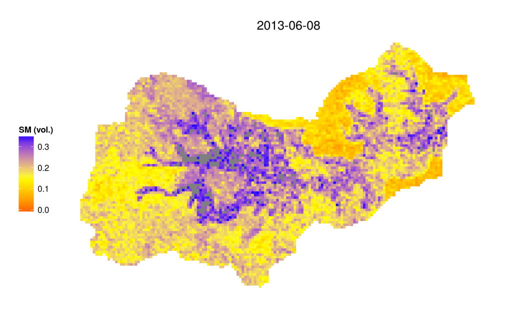
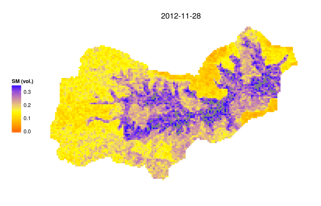
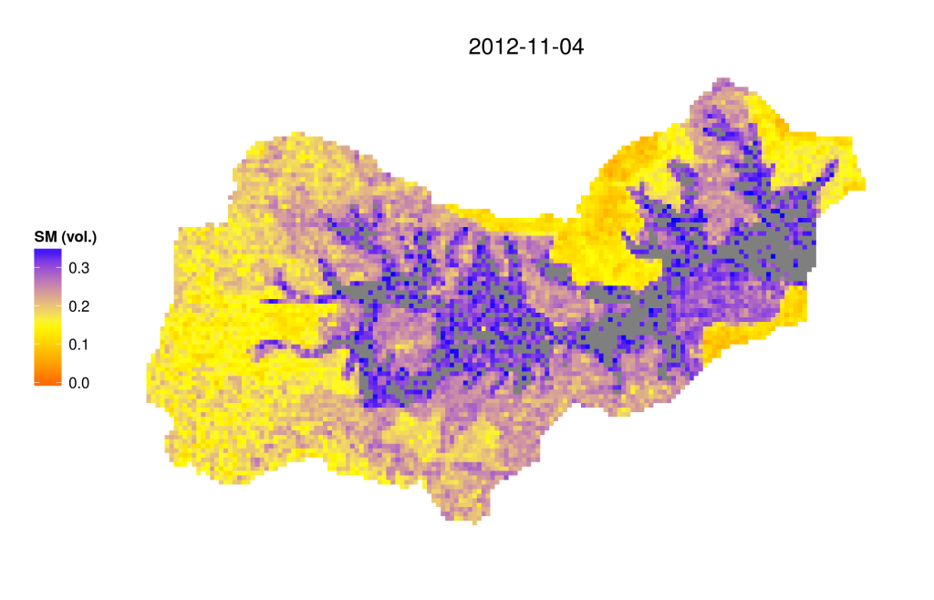
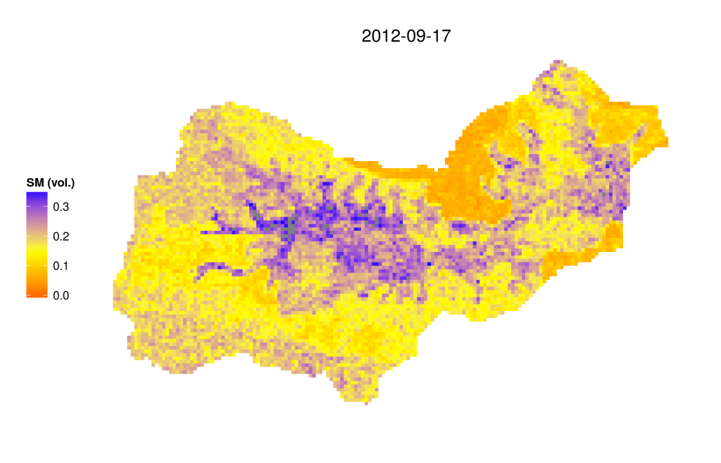
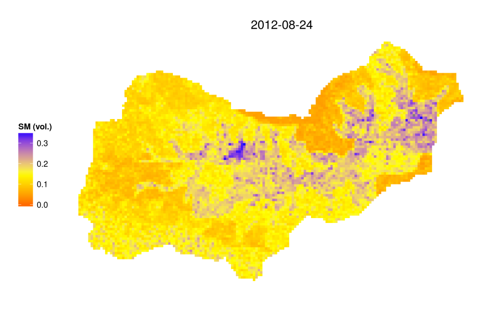
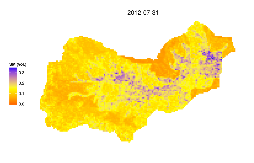
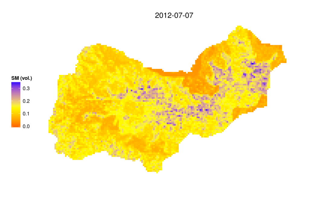
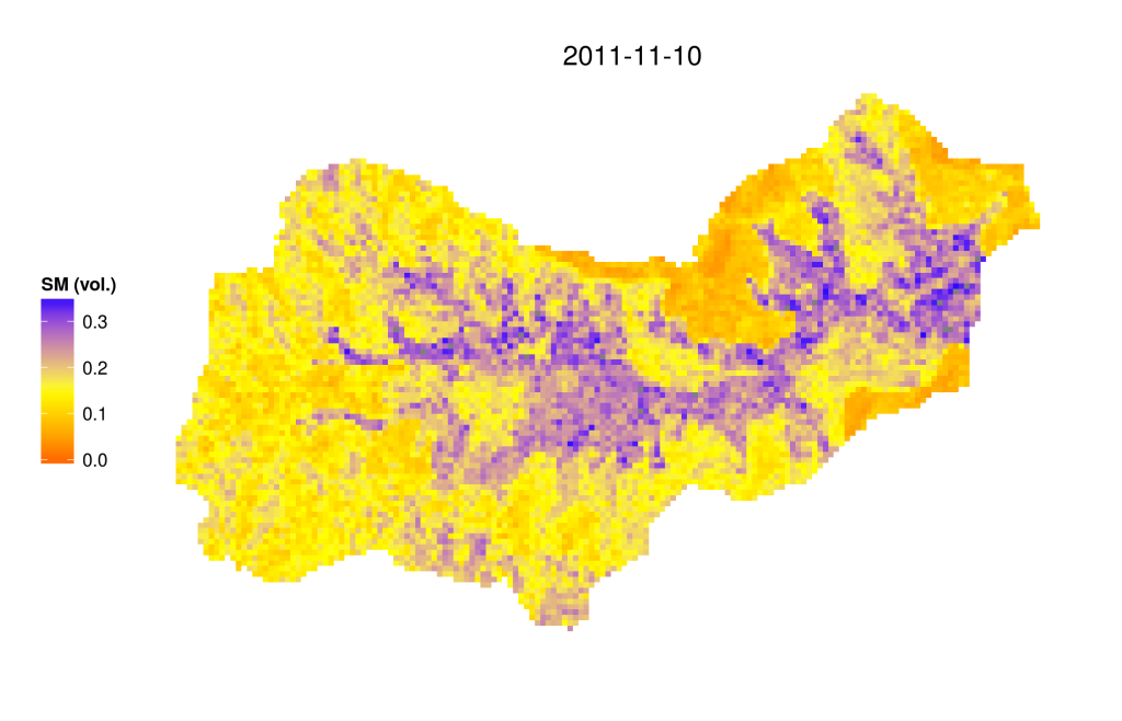
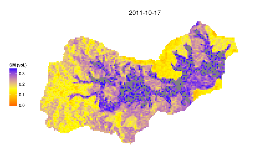
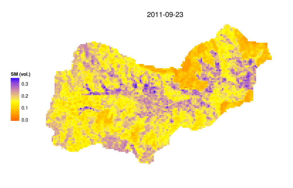
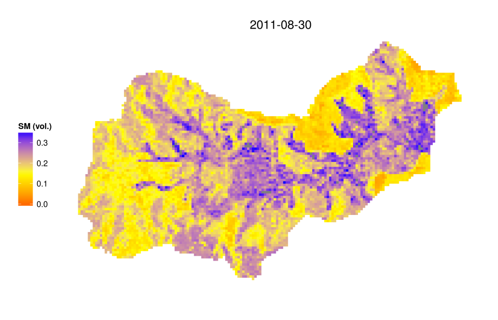
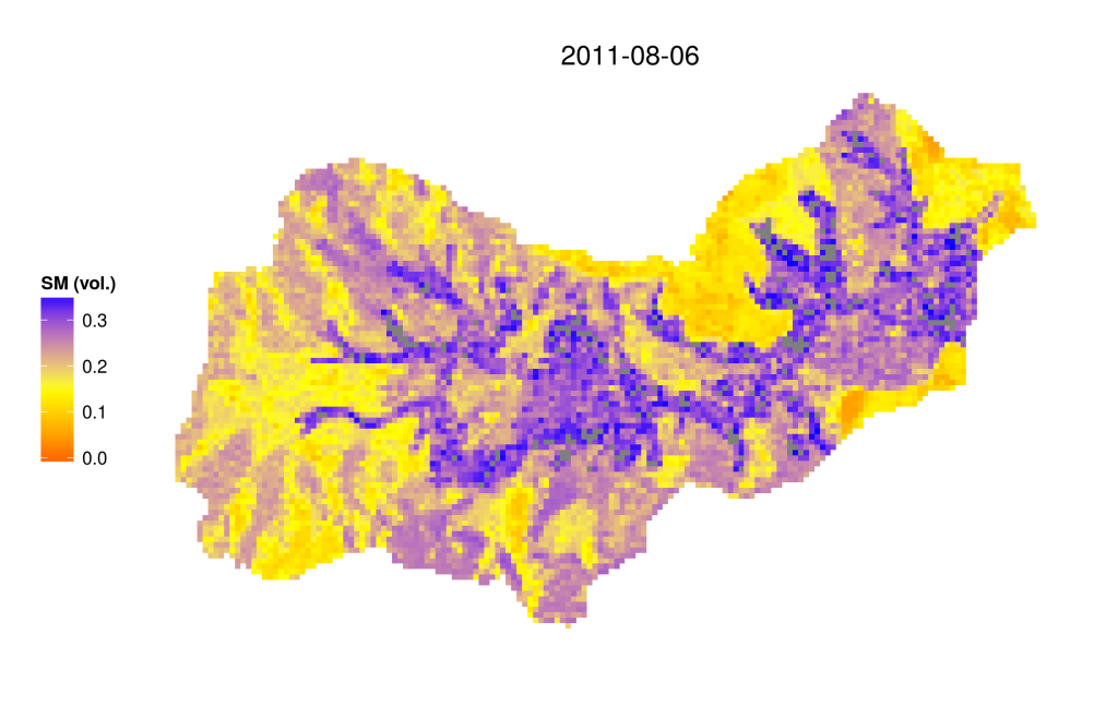
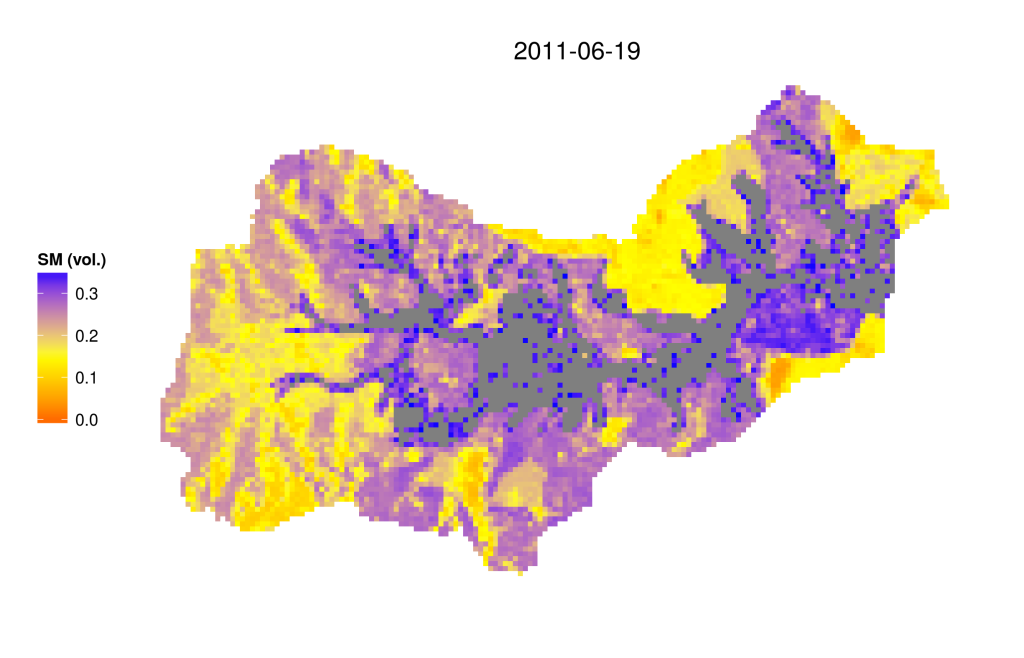
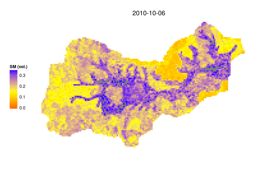
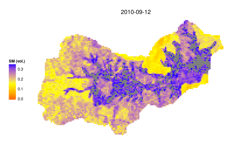
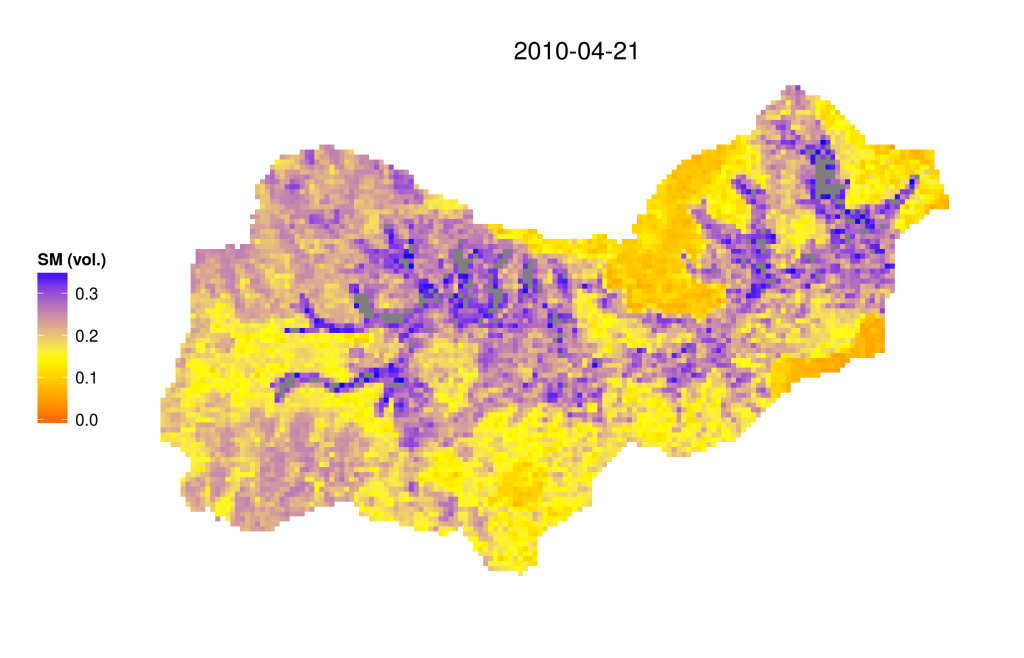
Soil Moisture Estimation from Remote Sensing
Details are provided here.